Land Subdivisions


placeholder+image

Licensed Surveyor

What is a licensed surveyor?

The work of a surveyor is highly skilled. Licensed surveyors are qualifed and trained to survey and re-establish property

boundaries.

A licensed surveyor provides certainty about the location and extent of your land, and helps protect you from boundary disputes

and expensive litigation.

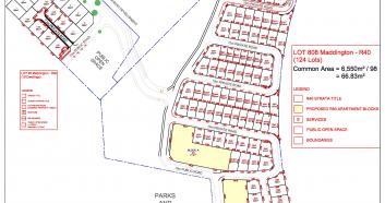
When you use a licensed surveyor, he/she will provide you with a sketch or plan of the land with a certifcate within 30 days of

completing the survey. This ‘reg25A’ certifcate is your legal protection.

Read more


Maddington Subdivision

Clients: Claymont

Scope: Cadastral, Consultation and Engineering

Project Duration: TBC

Start Date: Sep 2016


Project Overview

Our Client Claymont is developing an $85 million landmark development in Maddington Wa.

With stage one complete and selling we are currently working on Stage 2 and 3 consisting of 130 lots and public open spaces


Scope of Works

Land Subdivisions

UNDERSTANDING LAND SUBDIVISION

The capacity to subdivide your property is mainly based on the zoning and size of your lot.

Each residential area has a residential density code that is shown on the city’s Town Planning Scheme Map. The density code has an “R” and then a number value – for example, R20, R40 or R60.

The numerical value specifies the maximum number of dwellings permitted per hectare. For example, R20 indicates 20 dwellings per hectare.

Each density code also has minimum and average Lot area requirements (see further down).

Feature, Contour & Topographic Surveys

Learn More

Boundary Surveys

Learn More

Land Subdivisions

Learn More

Engineering Surveys

Learn More