Engineering Surveying is the broad term used to describe the work of surveyors on civil engineering jobs. The role of an engineering surveyor is a lot larger than simply set out for construction of a structure and survey pick-ups. Engineering Surveyors will usually be the professionals who first examine a finished design for a project and often will identify any design or practicality issues.
Need an engineering survey? We provide expert service! Visit our Engineering Surveys Page.
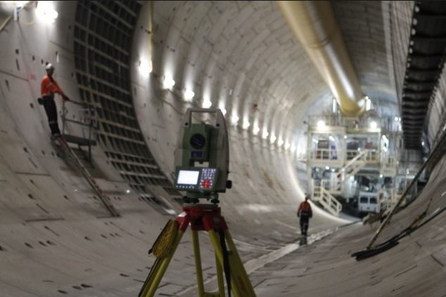
Engineering Surveyors will use a wide range of instruments to assist them with their on-site work. The most common of these will be the Total Station, GPS and Dumpy Level or Digital Level. At Land Surveyors Perth, Leica is the manufacturer of all equipment the company uses and this provides surveyors with seamless interaction between all instruments.
The surveyor receives the plans for the job and after review, will begin to draw them on a CAD based computer programme. During the drawing and calculation stage, the surveyor will be able to identify any issues in the design or any they see in terms of the practicalities of building the structure. If any issues are found, the surveyor will liaise with the engineering team and help in a preparation of a technical query.
Once the design is plotted and calculations are completed, the work on site will begin. The surveyors will first establish a network of control points around the site in a position predetermined with engineers and supervisors on site. The control points need to be in useful, safe and accessible areas but also in areas where they will not be disturbed.
When the work commences, the surveyors always communicate with the site supervisor and discuss which is the best and safest way to proceed with the setting out or survey task at hand. Land Surveyors Perth staff bring a wealth of knowledge to construction sites and the coordination between surveyor and supervisor always ensures that the most practicable solution to a setting out or survey task is always adhered to.
Once all the survey data has been recorded, the Engineering Surveyor will return to the office to process the data, complete calculations and finally complete the as-built documentation. The as-built documentation may be presented on a drawing, spreadsheet or a combination of both.